In February 2020 I joined Barry Kemp’s team working at Amarna as a digital archaeologist recording the site and surveying areas for future work, in particular the sanctuary at the eastern end of the Great Aten Temple temenos. Although my time was cut short by the COVID-19 pandemic, I did manage to capture a substantial area as outlined in the Great Aten Temple Report on Recent Work (February–May 2020). Photogrammetry enables real-world data to be used in the construction of assets and materials for the Amarna3D model. Visiting and working at Amarna gave me an invaluable insight into the environment and the opportunity to discuss the site in a wider context with the archaeological team who had worked there for many years. In addition, I was able to study the materials present in the construction of the city, the flora, fauna, and weather, all of which can be used to develop the next evolution of the Amarna3D model.
Data Capture
My primary remit was to attempt a photogrammetric survey of the structures within the Great Aten Temple enclosure which measures approximately 800 x 300m. For this season I would be working on the eastern end. We are not permitted to use drones to photograph the site so surface based methods would need to be used.
In addition to this task, I wanted to capture small areas for use within a 3D reconstruction of the city either as material textures or 3D assets. I was also keen to get a feeling of the environment in terms of topography, sounds, smells, temperature, etc. A mixture of photography, video, photogrammetry, and casual interviews with the team were used to gain a deeper understanding of the site which cannot be gained remotely. I had several opportunities to walk through the city with other team members (and local police) where I was able to see structures I had only seen in plan or old photographs. It was invaluable to me as a 3D artist / archaeologist to gain a sense of scale for the city layout.
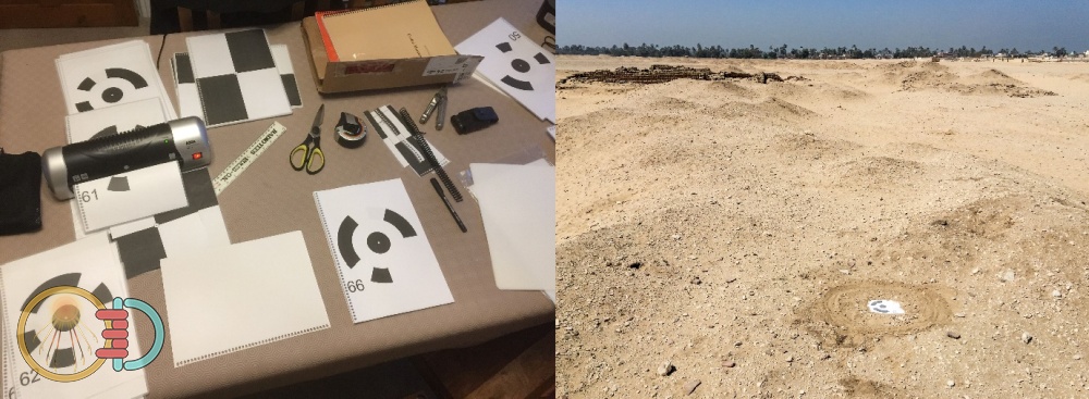
Figure 1, photogrammetry markers being prepared (left) and in use (right)
Equipment and method
Photogrammetry uses a series of photographs taken from many viewpoints to cover all visible surfaces of the subject so that it can be reconstructed as a 3D model later using suitable 3D photogrammetry software. The process is widely described online and in numerous papers (for example Mallison and Wings 2014) and I wrote a quick overview of the process for the Amarna Project website (Docherty 2019). For the spring 2020 season I used three methods to capture data, using a Canon EOS M series digital SLR, a miniature camera and gimbal (DJI Osmo Pocket), and a specially constructed gravity gimbal I designed in CAD and 3D printed myself, see Figure 2. The gravity gimbal allowed 3 action cameras to be mounted horizontally giving a 360-degree coverage as both still frame and video footage. This allowed for a light compact and portable system to be taken to Amarna and the opportunity to experiment with different methods of capture which I outlined in the subsequent Amarna Excavation Report (Barry Kemp et al. 2020). Both the Osmo and the 360-rig were mounted on an extendable boom pole to give added height. The 360-degree rig was scheduled to be used to take 360-degree video for testing as a VR experience. I had organised for this capture to take place towards the end of the excavation period prior to site closedown. Unfortunately, due to the COVID-19 pandemic the trip was cut short, and the capture did not take place. It has been rescheduled for the next time I am able to travel to Amarna.
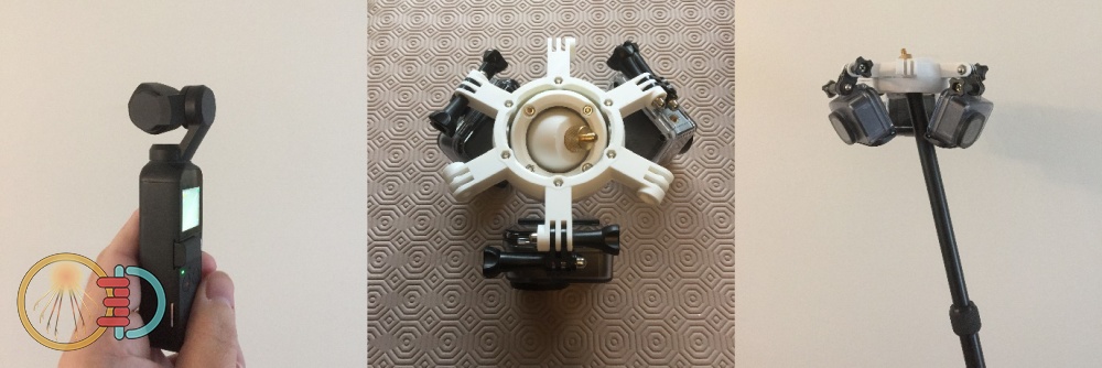
Figure 2, photogrammetry equipment. DJI Osmo Pocket (left), custom action camera rig (middle & right)
To maintain accuracy in the physical measurement of the site, ground control targets (GTC) were laid down and surveyed by Anna Hodgkinson and Miriam Bertram. The data from these GTC’s was then used to scale and orient the reconstructed models later in software. Captures took place at just after midday to prevent long shadows as the site was too large to shade by sheets, tents, etc. Capture processing on the laptop was done overnight and into the morning prior to the next capture slot in the afternoon. The electricity supply at the dig house could go off periodically through the evening and night so I setup batch scripts which allowed for the processing to be saved and resumed if required; fortunately, the laptop battery held out during those episodes.
Summary of captured features and areas
Initial capture was directed towards the eastern end of the temple enclosure wall encompassing the Sanctuary, the house of Panehsy, the building in the north-eastern wall, the House of Foreign Tribute, and the Butchers Yard. Unfortunately, there was not enough time to capture all these areas, and there were some failed captures. However good progress was made, and Figure 3 shows the areas which were successfully captured and the areas which are yet to be processed are shown as red grids. The background grid squares are at a size of 200 x 200 m. The following pages give a brief overview of the features captured during my time at Amarna.
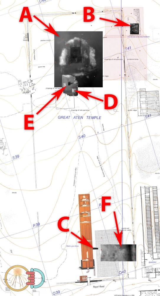
Figure 3, areas around the Great Aten Temple captured through photogrammetry; (A) the Sanctuary, (B) Panehsy’s House, (C) offering tables, (D) the Butchers Yard, (E) site of the Stelae, (F) site of possible temple dump. Base map is taken from (Kemp and Garfi 1993)
The Sanctuary (A)
Figure 4 shows the model of the Great Aten Temple Sanctuary from above facing north-east, whilst Figure 6 shows the derived surface height, from the model, as a colour gradient. For an illustration of what the Sanctuary may have looked like please refer Figure 7.
Figure 4, the Sanctuary model from above facing north-east
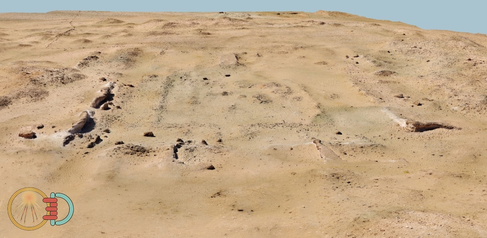
Figure 5, the Sanctuary model view to the west
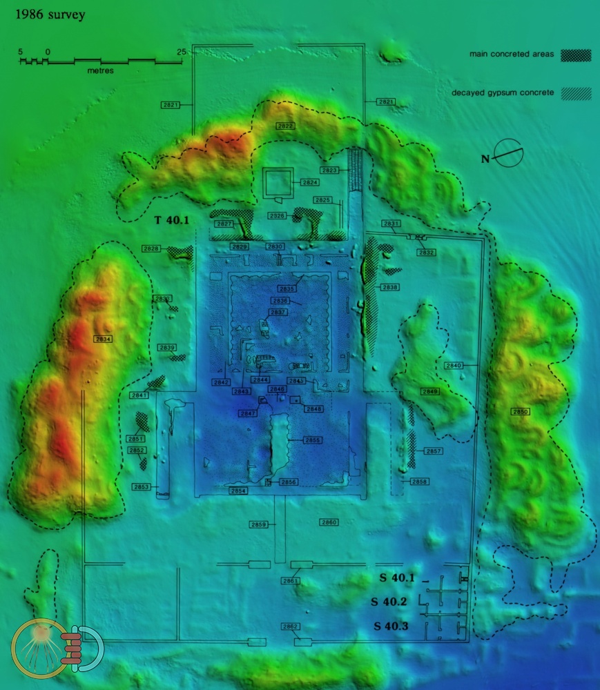
Figure 6, the Sanctuary surface height represented by colour gradient with 1986 survey (Kemp 1987) overlaid
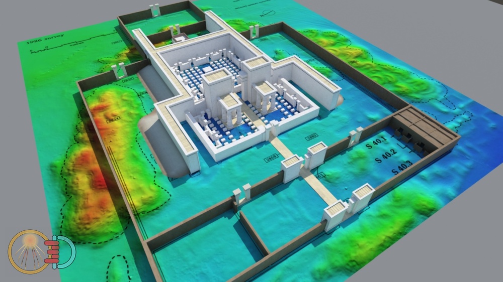
Figure 7, 3D reconstruction of the Sanctuary based on plans and photogrammetric survey conducted by Paul Docherty
Panehsy’s House (B)
The house of the high priest (First servitor of the Aten) Panehsy (T41.1) is located on the south-eastern edge of the Great Aten Temple enclosure albeit outside of the enclosure wall. This Panehsy is the same as the owner of rock tomb no. 6, and a large house in the Main City (R44.2). He also held the title ‘Keeper of the cattle of the Aten’ (Kemp 2006). Panehsy’s house is the source of the well-known carved limestone shrine now on display in the Egyptian Museum, Cairo (Pendlebury 1951, Pl. XXXI; The Amarna Project 2017).
Figure 8 shows the house of Panehsy from an elevated height looking towards the south. Near the centre of the image can be seen a small white target used during the photogrammetric capture and is close to the site of the shrine to the Aten which was excavated during the 1930’s. Figure 9 shows a side elevation looking towards the south, whilst Figure 10 shows a view looking towards the north-west. Figure 11 shows an orthographic top view with a plan of the house drawn in 2006 composited over.
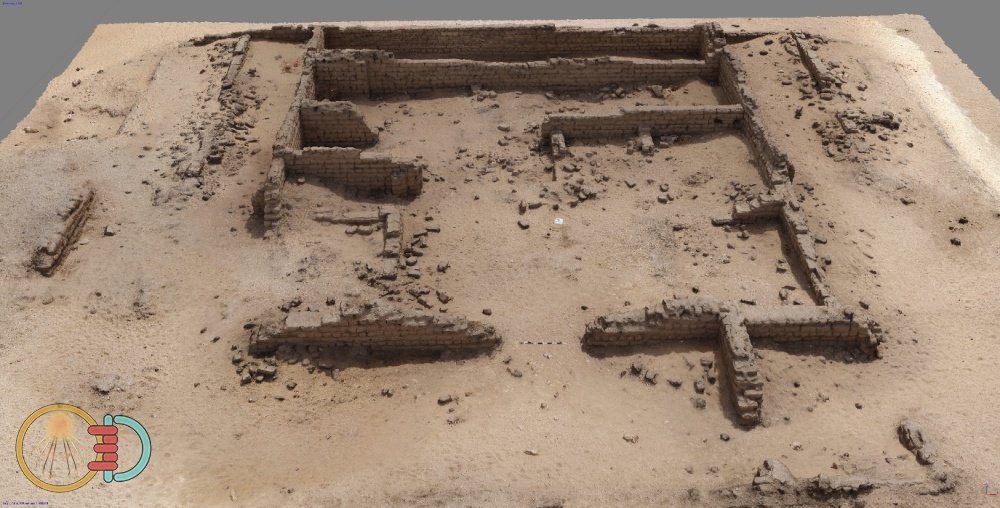
Figure 8, the house of Panehsy model view towards the south
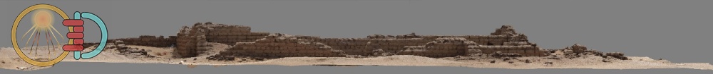
Figure 9, the house of Panehsy model side elevation view towards the south
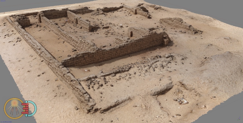
Figure 10, the house of Panehsy model view towards the north-west
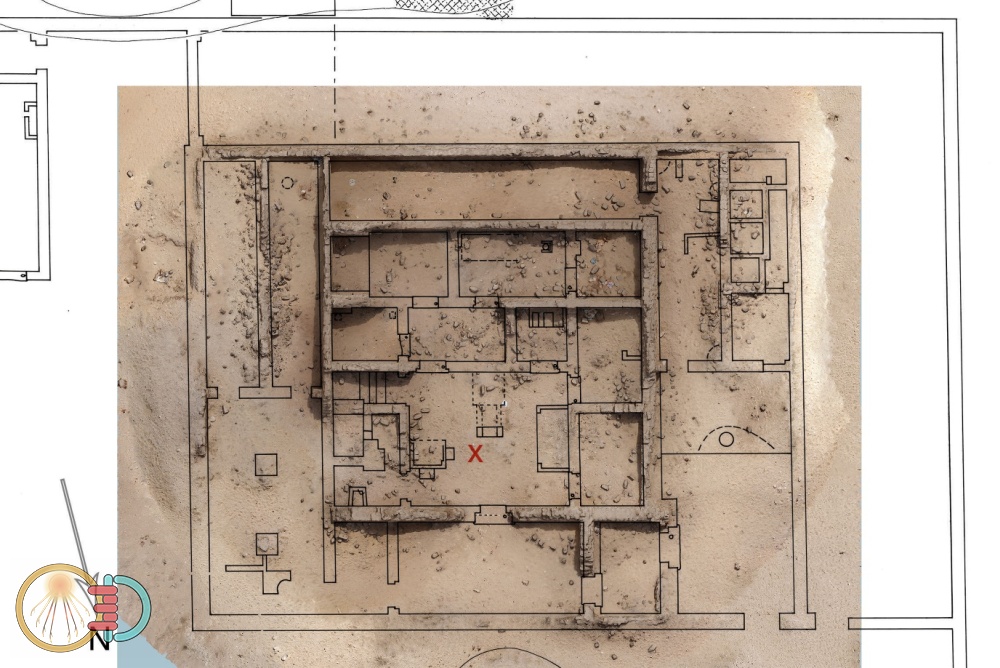
Figure 11, the house of Panehsy orthographic top view of model with 2006 plan (Kemp 2006, 46) overlaid
This capture was useful in enabling me to see the brick construction of the houses. The resulting photogrammetric model can be used for 3D assets and 3D textures, see Figure 12 which shows some large patches of ground which could be edited into detailed tileable textures. This can be achieved by identifying useful features and cropping the model to isolate them for later use.
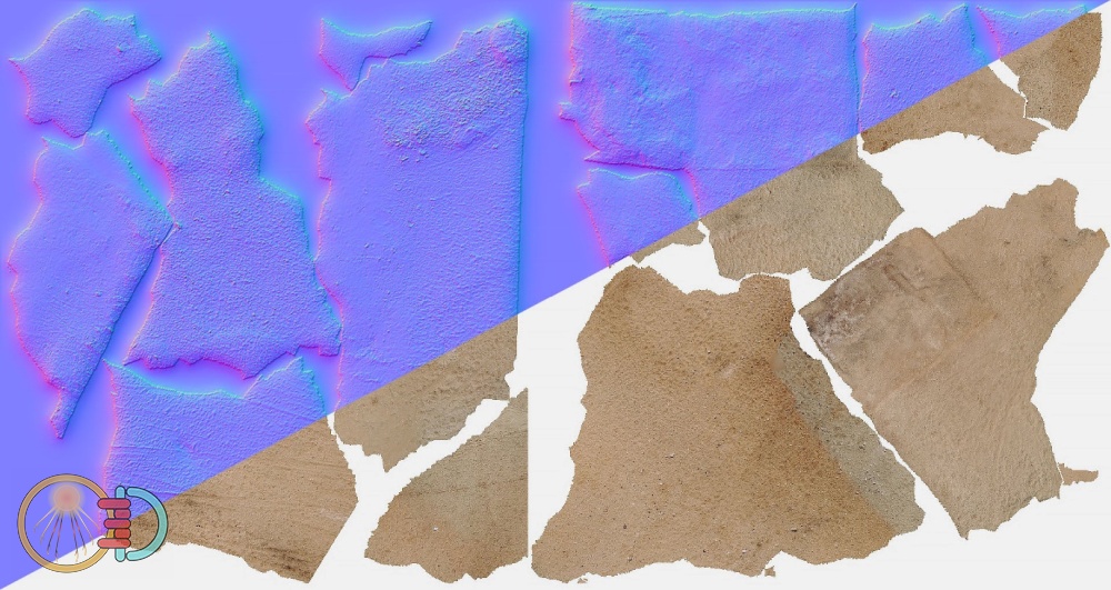
Figure 12, texture swatches derived from photogrammetry. Normal map (top) diffuse map (bottom)
Great Aten Temple Offering Tables (C)
Photogrammetry was also used to record the trench on the south of the temple wall where 4 offering tables were excavated as shown in Figure 13. A top view orthophoto was derived from the 3D model along with profiles of the trench walls. These can aid in the interpretation and subsequent illustration of the trench particularly where it is possible to remove elements of the structure for clarity. This can be seen in the profile sections in Figure 14 and Figure 15 where the offering tables have been removed digitally showing the wall strata in more detail.
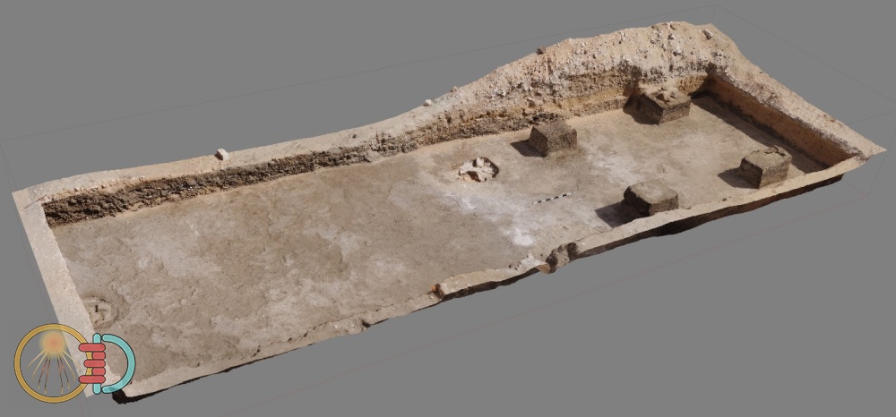
Figure 13, trench with offering tables
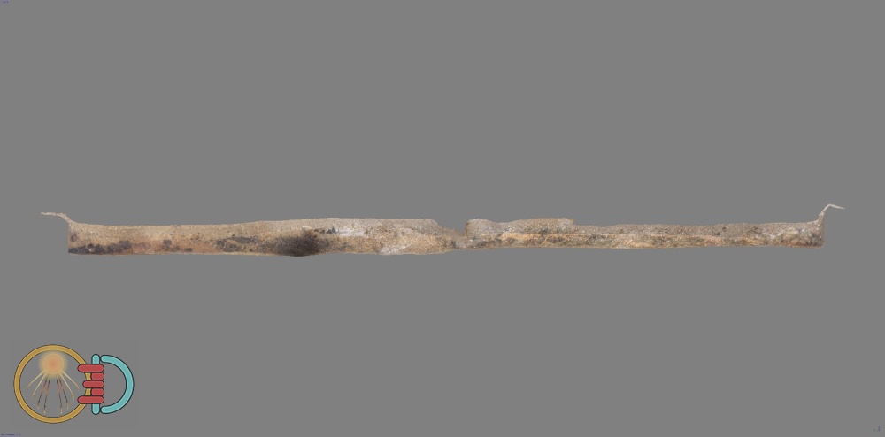
Figure 14, section of trench looking towards the west
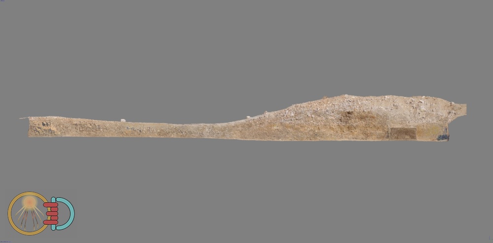
Figure 15, section of trench looking towards the east
The Butchers Yard (D)
After excavation was completed at the Butchers Yard, the site was also captured, and the results are shown in Figure 16. Additionally, a small collection of broken pottery was captured in detail using the DSLR with the resulting model shown in Figure 17. By having a 3D model, it is possible to revisit the pottery assemblage as it was prior to excavation and so aid in later interpretation.
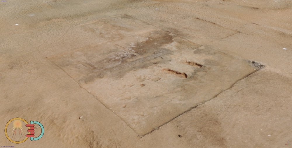
Figure 16, the Butchers Yard perspective view towards the north-east
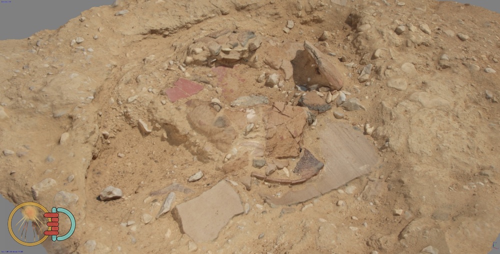
Figure 17, pottery assemblage from the Butchers Yard
The North Tombs
A visit to the Northern Tombs offered an unscheduled opportunity to capture the inside of the tombs belonging to Panehsy and Meryra. Internal photogrammetry relies heavily on good lighting and without an appropriate lighting rig the images will normally have additional noise and colour casts that will impact the quality of the 3D reconstructions. The photogrammetric captures conducted here did not have a lighting rig so the tomb floor lights were the only available source and as such affected the quality of the capture as can be seen in the images. However, as a test capture it was successful. The Osmo Pocket was used to capture the outer chambers of both tombs and coped extremely well with the reduced lighting. The pole mount was utilised where appropriate to maintain a regular distance from the wall surfaces and achieve the necessary height.
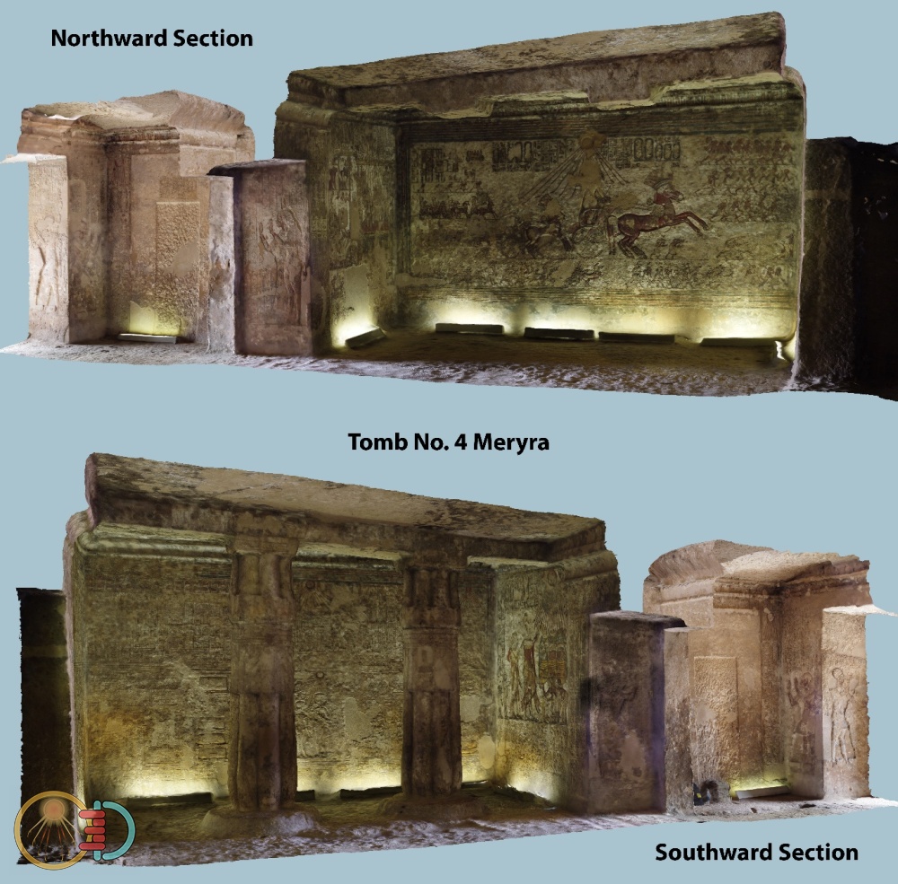
Figure 18, photogrammetric reconstruction of tomb no.4 belonging to Meryra
Figure 18 shows a half section of the tomb in 3D. Figure19 shows a cropped corner of the tomb with the western wall highlighted and presenting the wall surface relief in 3D detail. Figure 20 shows the western wall painting with the nearby column removed for clarity and simple colour enhancement to indicate what may be possible given better lighting conditions.
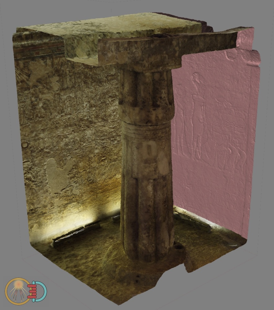
Figure 19, cropped corner of the tomb with the western wall highlighted and presenting the wall surface relief in 3D detail
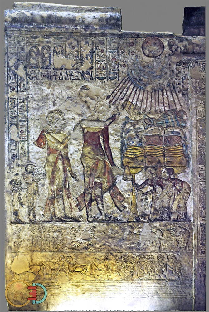
Figure 20, orthographic model view of the western wall painting with column removed to aid clarity
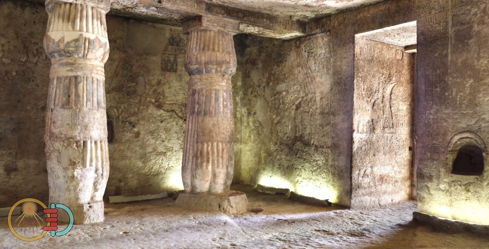
Figure 21, photogrammetric reconstruction of tomb no.6 belonging to Panehsy
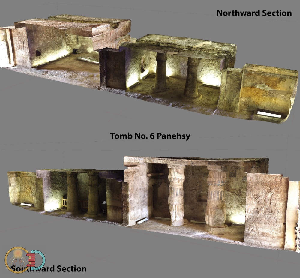
Figure 22, photogrammetric reconstruction of tomb no.6 belonging to Panehsy
The Amarna House
The house identified for tourists as ‘the Amarna House’ (Q44.1) is located near to the south side of the Small Aten Temple. It has been preserved as a show house and includes a raised observation platform from which visitors can look down into the structure. I made a quick capture of the house and was planning a more detailed capture to be used later for material creation towards the end of my planned time at Amarna. Unfortunately, circumstances prevented this from happening, however the initial 3D model results can be seen in Figure 23.
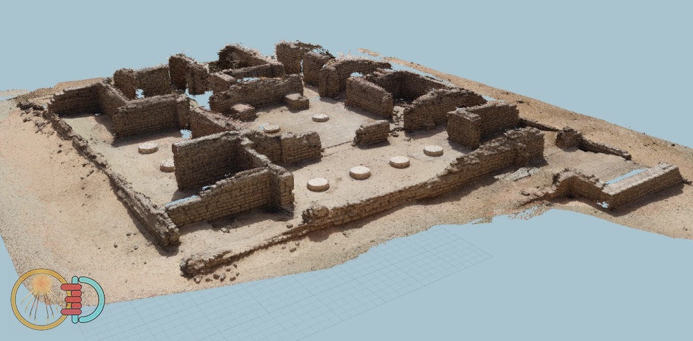
Figure 23, photogrammetric reconstruction of the Amarna Observation House
Photogrammetry is an extremely useful and cost-effective tool for capturing and archiving not only artefacts but sites and features. Its use extends to the capture of assets which can be implemented later within a larger 3D reconstruction of the city.
Team members and acknowledgements
The team over this period (autumn 2019 and spring and autumn 2020) comprised Barry Kemp (director), Miriam Bertram, Fabien Balestra, Marzia Cavriani, Alisée Devillers, Tim Hagedorn, Sue Kelly, Julia Vilaró (archaeologists), Anna Hodgkinson (archaeologist, workshop study group), Juan Friedrichs (artist and archaeologist), Marsha Hill, Kristin Thompson (sculpture), Alexandra Winkels (gypsum analysis), Sarah Doherty (ceramics), Paul Docherty (photogrammetry), Frederik Rademakers (metallurgy), Rainer Gerisch (wood and charcoal), Cecilie Lelek Tvetmarken (flotation of samples and botanical identifications), Margaret Serpico (incense) and Andreas Mesli (photography). The Ministry of Antiquities was represented by Nasriin Sobhy Ahmed, Hamada Abd el-Aziz and Mazhar Khalifa (site inspectors), Mustafa Mohamed Gamal (site conservator), and Mohamed Abd el-Mohsen and Tharwat Shawki Damian (magazine inspectors). The expedition also wishes to acknowledge its debt to the Permanent Committee of the Ministry of Antiquities for permission to work at Amarna, and to the antiquities officials of Middle Egypt, especially Gamal Abu Bakr in Minia, Mahmoud Salah for South Minia, Fathy Awad, the general director of archaeology for the Mallawi area and Hamada Kellawy, the chief inspector of Amarna. The prompt delivery of cut blocks of limestone from the Tura quarries and granite blocks from Aswan needed for the building work at the temple was thanks to Nicholas Warner and Mahmoud El-Tayeb in Cairo.
Bibliography
Barry Kemp et al. (2020). Great Aten Temple Report on Recent Work (February–May, 2020). Cambridge . [Online]. Available at: https://www.amarnaproject.com/documents/pdf/great-aten-temple-report-Feb-May-2020-3.pdf.
Docherty, P. (2019). Photogrammetry at Amarna. Horizon, 20 (Autumn), pp.18–19. [Online]. Available at: https://www.amarnaproject.com/documents/pdf/horizon-newsletter-20.pdf.
Kemp, B. (2006). Tell el-Amarna, 2005–06. Journal of Egyptian Archaeology, 92, pp.21–56.
Kemp, B. J. (1987). Amarna Reports IV. London : Egypt Exploration Society.
Kemp, B. J. and Garfi, S. (1993). A Survey of the Ancient City of el-‘Amarna. London : Egypt Exploration Society.
Mallison, H. and Wings, O. (2014). Photogrammetry in paleontology – a practical guide. Journal of Paleontological Techniques, 12, pp.1–31.
Pendlebury, J. D. S. (1951). The city of Akhenaten. Part III: The Central City and The Official Quarters. The excavations at Tell el-Amarna during the seasons 1926-1927 and 1931-1936. London : Egypt Exploration Society.
The Amarna Project. (2017). The Central City. [Online]. Available at: https://www.amarnaproject.com/pages/amarna_the_place/central_city/index.shtml.