Aerial view of the City
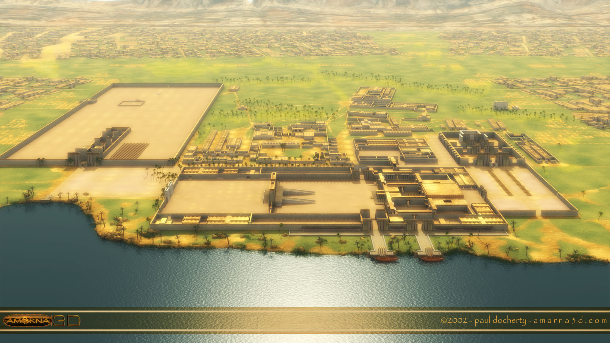
This view is facing east with the River Nile running along the bottom of the image. On the left we can see the Great Aten Temple whilst on the right is the Small Aten Temple.
This view is facing east with the River Nile running along the bottom of the image. On the left we can see the Great Aten Temple whilst on the right is the Small Aten Temple.
Dear Paul
I just finished to read the book of written by J.D.S. Pendlebury translated in French by Henri Wild (in a marvelous french language) issued by Payot in 1936….Thanks to your 3 D reconstructions it’s much easier to link description of temples and city and the 3D images. Tnank you so much.
Sincerely yours
Thanks Alain,
I also have that book [in French] and a copy in English. I plan on writing more about Pendlebury and his excavations at Amarna along with Petrie’s work. In the new version of the model I will be looking at it from their point of view so it should work more as a visual to their digs.
Amazing reconstructions of this hidden city!! Such detail! I love the interactive views and feels like google earth! Its incredible!! Thankyou